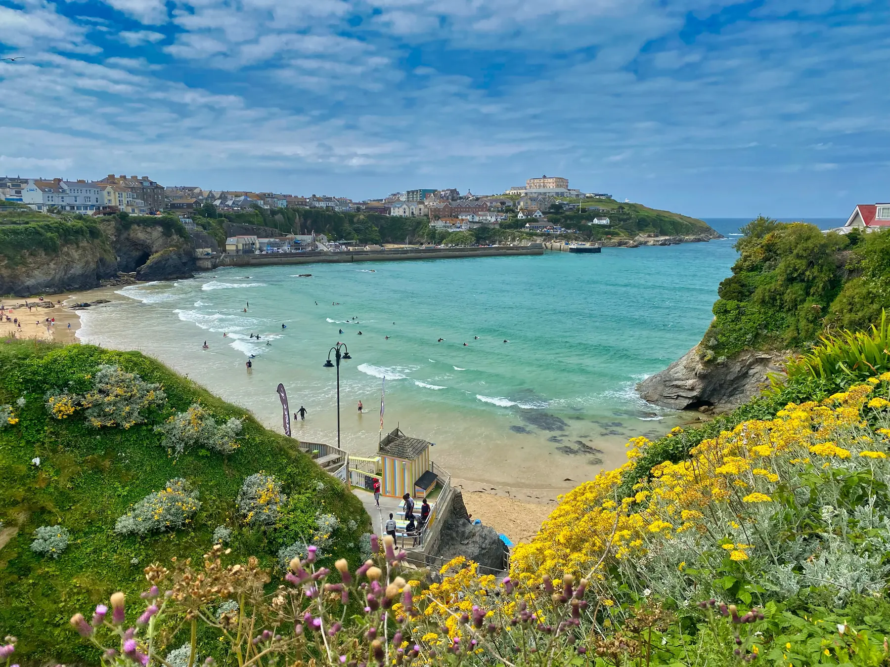
Newquay is a town built along the top of a cliff, and the walking here is almost entirely coastal. The South West Coast Path runs straight through it, north-east towards Watergate Bay and Bedruthan and south-west across the Gannel towards Crantock, Holywell and the old tin coast at St Agnes.
Between those two directions you have most of what north Cornwall does best: sand, headlands, engine houses on cliff edges, and an estuary that fills and empties twice a day.
Distances are from the town centre.
The blunt headland at the western end of the town, between the harbour and Fistral. Twenty minutes out and back from the town centre, with the Huer’s Hut on the way — a small whitewashed building where a lookout once watched for the darkening of the water that meant a pilchard shoal, and shouted hevva to bring the boats out.
From the end of the head you get Fistral on one side, the harbour and Towan Beach on the other, and the whole north coast running away east.
The larger headland on the far side of Fistral, reached round the beach or across the town. Open grassland, a car park, cliffs on three sides and the mouth of the Gannel below. The circuit of the head takes about an hour and is one of the best short walks in Cornwall for effort against reward.
The tidal estuary that forms the town’s southern boundary is the most interesting piece of geography around Newquay. At high water it is a wide creek full of boats; at low water it is a plain of sand you can walk across.
Several crossings link Newquay to the Crantock side, and they are worth understanding before you set out: there are seasonal footbridges that are usable only around low tide, a summer ferry, and a tidal road crossing at Trenance. All of them depend on the state of the tide, and the standard Newquay mistake is walking out to Crantock at low water and finding no way back three hours later.
Check the tide, or go round by the road bridge at Trevemper.
Crantock Beach, across the Gannel and about three kilometres from the town, is National Trust and one of the finest beaches in Cornwall — a wide bowl of sand with the estuary running out through it and dunes behind. There is free National Trust parking above it.
Beyond Crantock, the path runs to Porth Joke — universally called Polly Joke — a small, undeveloped cove with no facilities and no road access, which is exactly why people walk to it. Beyond that again is Holywell Bay, with big dunes and the two rocks offshore that appeared in the Poldark titles.
Newquay to Polly Joke and back is about eleven kilometres and one of the best days out here on foot.
Sixteen kilometres south-west, and the finest stretch of the Cornish mining coast. Wheal Coates is a ruined tin mine standing on the cliff face itself, its engine house perched above the sea, preserved by the National Trust and probably the most photographed industrial building in Britain.
The clifftop walk from St Agnes Head past Wheal Coates to Chapel Porth is around five kilometres, spectacular the whole way, with a beach café at the far end. It is a drive from Newquay rather than a walk, and it is worth it.
The coast path north-east from Lusty Glaze runs above three kilometres of almost continuous sand at Watergate Bay, then on over the cliffs to Mawgan Porth. Around eight kilometres one way, with buses back.
Eight kilometres north-east, and one of the great sights of the Cornish coast: a line of dark slate stacks standing in the surf below a high cliff, with a National Trust clifftop path above and a steep staircase down to the beach. The stacks are said, in a Victorian invention, to be the stepping stones of a giant called Bedruthan.
The beach is dangerous — no swimming, and it is cut off by the tide — but the clifftop walk is superb and free apart from the car park.
Four kilometres inland at Kestle Mill, a small Elizabethan manor house with a great hall, plaster ceilings and an orchard, run by the National Trust. It is a complete change of register from the coast and a good wet-afternoon walk in the grounds.
Five kilometres inland, a fifteen-inch gauge railway runs from Benny Halt to the site of East Wheal Rose, a lead mine that was the scene of Cornwall’s worst mining disaster in 1846. There are walks around the site, boating and a maze.
Behind the town, Trenance Gardens and the boating lake sit in a wooded valley with the zoo above them, and paths run inland along the Gannel.
Tides govern everything on this coast. Check them before crossing the Gannel, before walking below Bedruthan, and before setting out along any beach. Several of the coves are cut off at high water.
Buses run along the coast to Watergate Bay, Mawgan Porth, Padstow, Perranporth and St Agnes, which makes one-way walks easy.
Parking. Crantock and Pentire are free; Fistral, Mount Wise, Manor and Tregunnel Hill are the town car parks.
The coast path here is cliff-top and exposed, with steep descents into every cove. It is more strenuous than the distances suggest.
Surf and rips. These are Atlantic beaches with strong rip currents. Swim between the flags where there are lifeguards, and be careful at unpatrolled beaches like Polly Joke.
Spring brings the cliff flowers — thrift, sea campion and kidney vetch on the headlands — and the clearest air of the year. The coast path is dry and empty before Easter.
Summer is when the beaches fill and the coast path does not. Almost everyone stays on the sand, which means an hour’s walk in either direction gets you to genuinely quiet ground even in August. It is also when the Gannel crossings are in place.
Autumn is the best walking here: warm sea, big Atlantic swells breaking against the headlands, and the light on the cliffs at its best. Seal pups appear along the coast.
Winter is the season for storm watching. Fistral and the headlands in a proper Atlantic blow are a spectacle, and the coast path is empty. It is also the season for slips and undercut edges — stay well back.
More than most people expect. Grey seals are resident and visible from the headlands and from Bedruthan. Dolphins pass through, sometimes close in. Basking sharks appear in early summer in some years. And choughs — the red-billed, red-legged crow on Cornwall’s coat of arms, extinct in the county for decades — have recolonised the cliffs around St Agnes and Bedruthan and are now seen regularly along this stretch.
The clifftop grassland is also good for butterflies, and the dunes at Crantock and Holywell hold orchids in early summer.
Newquay’s bus network is better than most Cornish towns’. Services run north-east along the coast to Watergate Bay, Mawgan Porth and on to Padstow; south-west to Crantock, Holywell, Perranporth and St Agnes; and inland to Truro every half hour. That makes one-way coast path walks straightforward, which matters on a route where doubling back is a long way.
The branch line to Par has request halts along it — you have to tell the conductor — which opens up a couple of inland walks most visitors never consider.
At low tide, using the seasonal footbridges or the tidal crossing — but the tide comes in fast and the bridges become unusable. Check the times before you go.
Pentire Head for an hour, Crantock to Polly Joke for a half day, St Agnes Head to Chapel Porth past Wheal Coates for the best scenery.
Eight kilometres north-east, with a National Trust car park and a clifftop path above the stacks.
The seafront, Trenance Gardens and the Gannel valley paths. The coast path is not flat anywhere.
No. The beach is dangerous and gets cut off by the tide. Go for the view from the clifftop.